Nazca Lines (næzkə) are a series of ancient geoglyphs located in the Nazca Desert in southern Peru.
Located in the arid Peruvian coastal plain, some 400 km south of Lima, the geoglyphs of Nasca and the pampas of Jumana cover lot of area in the desert.

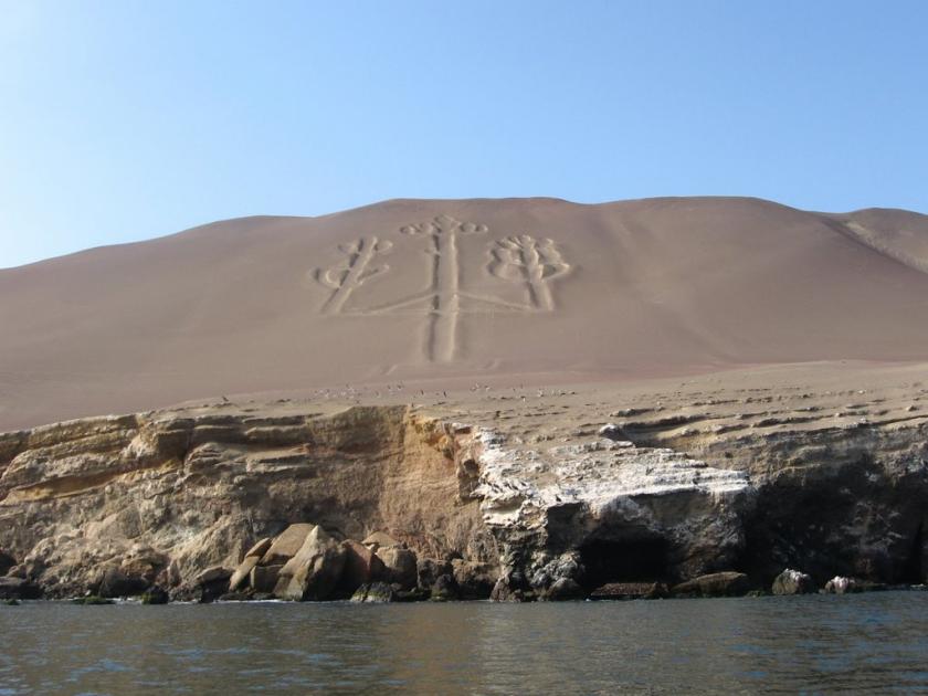
Some local geoglyphs resemble Paracas motifs.
Hundreds are simple lines or geometric shapes; more than seventy are zoomorphic designs of animals such as birds, fish, llamas, jaguar, monkey, lizard or human figures. Other designs include phytomorphic shapes such as trees and flowers.
The lines are shallow designs made in the ground by removing the reddish pebbles and uncovering the whitish/grayish ground beneath. The largest figures are over 200 metres (660 ft) across. Scholars differ in interpreting the purpose of the designs, but in general they ascribe religious significance to them.
Intensive study of the geoglyphs and comparison with other manifestations of contemporary art forms suggests that they can be divided into three chronological phases. The first dates from the Chavín period (500-300 BCE) and is characterized by the technique of forming figures by piling stones. This was an important time of cultural developments in the Andean region, with strong influence exerted in the Inca region from the north by the Formative Middle Late Culture.

The local development known as Paracas represents the second phase (400-200 BCE), again strongly influenced from the north. The town of Paracas adapted its culture skilfully to its severe location and achieved a high level of artistic development.

The third phase, which represents the great majority of the geoglyphs, is the Nazca phase proper. The Nazca culture derived directly from that of Paracas. The Andean towns developed a powerful religious system which produced, along with Moche on the northern coast of Peru, an outstanding culture represented by its handicrafts (notably pottery) and textiles. Most of the geoglyphs of this period are located close to villages of this culture, such as La Quebrada del Frayle, Cahuachi, Palpa and Ingenio, concentrated in Pampa de Jumana.


Two techniques were used to define the geoglyphs. In the earlier Chavín period they were defined in outline, the gravel being removed and piled inwards, so as to leave the figures in slight relief. For the most part, however, the technique used was the removal of the gravel from the figure, providing a solid figure that contrasts with its surroundings.


In reality, these Nazca lines of Peru are landing signal for the air chariots of pre-Colombian times. These are used as runways to take off and land ancient Vimanas.

Puranas lead to conclusion that area of Nazca desert was Ancient Airport of King Bali.
He must have established his kingdom, after leaving Kerala in India and settling in Patala Loka (South America) along with his men.
His next generations have built vimanas and flew all over the earth. Mahiravana was one such king, who could travel all over, but was later killed by Hanuman.
The Paracas Trident symbol etched on seashore in Peru pre-dates Ramayana era and indicates the establishment of Asura kingdom in South America.

In 1950s, American archaeologist William Duncan Strong and his team, Columbia University, excavated the city of Cahuachi, which is believed to be lived by those who produce Nazca lines.
Cahuachi city. Nazca was 12 km away from the line. The excavations here revealed a complex city plan connecting a large pyramid of mud bricks, several large temples, large squares, platforms and staircases and corridors.
Carbon 14 tests on burial finds indicate that the surviving tomb remains belonged to experts during the 5th century BCE and that the funeral dress with 500 dolls was over 2000 years old.

Some of the babies in the funeral dress are dancing with their hands open to the air. Some of them are composed of figures playing musical instruments. The Italian archaeologist went out of their way and suggested that Nazca native people were doing religious ceremonies in this city.
In entire Nazca Lines, there are more than 1,500 drawings covering a land of 3885 km2.
In the Nazca Desert, the upper part of the soil is iron oxide, so it is darker than the soil on the lower side. For this reason it creates a contrast between the upper and lower layers of the excavations on the soil. This is why the drawings are made more noticeable. According to the scientists; The fact that the nascent lines are protected for all these years is due to the fact that the region is drier as well as drier, and that the temperature is constant according to the surrounding areas.
The area was designated as a UNESCO World Heritage Site in 1994.